Recreational trails are connecting cities and towns throughout the Palmetto State in more ways than one. They can drive economic development, housing projects, expand a city’s footprint and cultivate healthier communities where businesses thrive.
One example of a trail adding value to its community is the Riverwalk Trail connecting the cities of West Columbia and Cayce to the Three Rivers Greenway. Opened between 2004 and 2005, the 8-mile path along the Congaree River provides ample space for walking, running and cycling.
Capitalizing on the energy that the Riverwalk brings, the City of West Columbia recently undertook its River District Redevelopment Project. Facing the challenge of revitalizing a low-density area experiencing a public parking shortage, the city worked directly with community groups, planning firms and key stakeholders to increase housing, public parking, greenspaces, public art installations, bicycle lanes and new businesses in its River District.
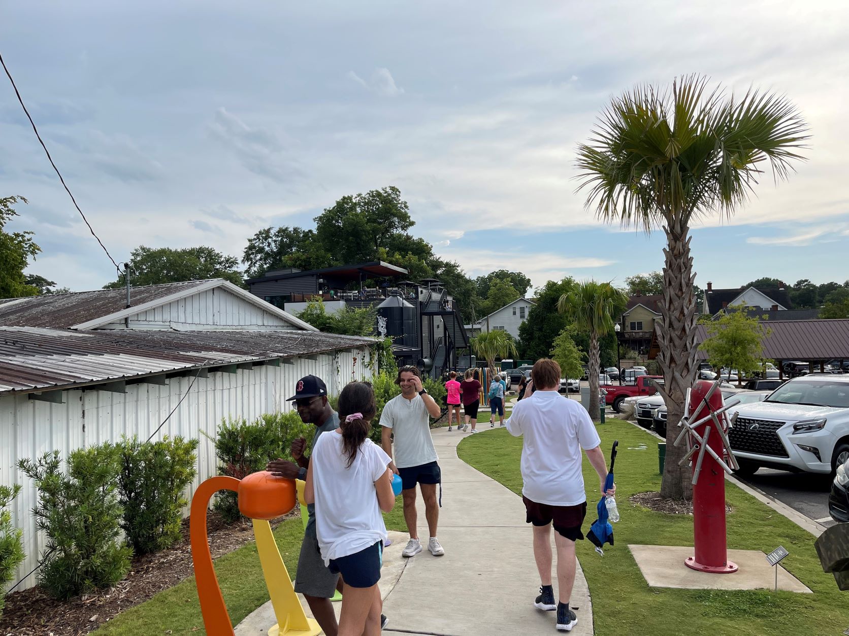
West Columbia’s Interactive Art Park connects the city’s
riverfront to a new brewery and the Meeting Street
Artisan Market. Photos: City of West Columbia.
Mayor Tem Miles explained that the first focus of the revitalization was the Riverwalk itself.
“[When] folks found out that the Riverwalk was over here, they would come to see just how beautiful of a setting it was, which led to more energy and activity in our River District,” he said.
He added that businesses and residential investments have all flourished from the revitalization activity that resulted from the Riverwalk.
To enhance connectivity, the city plans to push the energy from the River District into other areas of town. It added an Interactive Art Park and an Americans with Disabilities Act-compliant pathway that connects to Savage Craft Ale Works, a newer business that opened in January. The extension of the B Avenue Bike Lane also linked the River District to the Triangle City area and the Community Center.
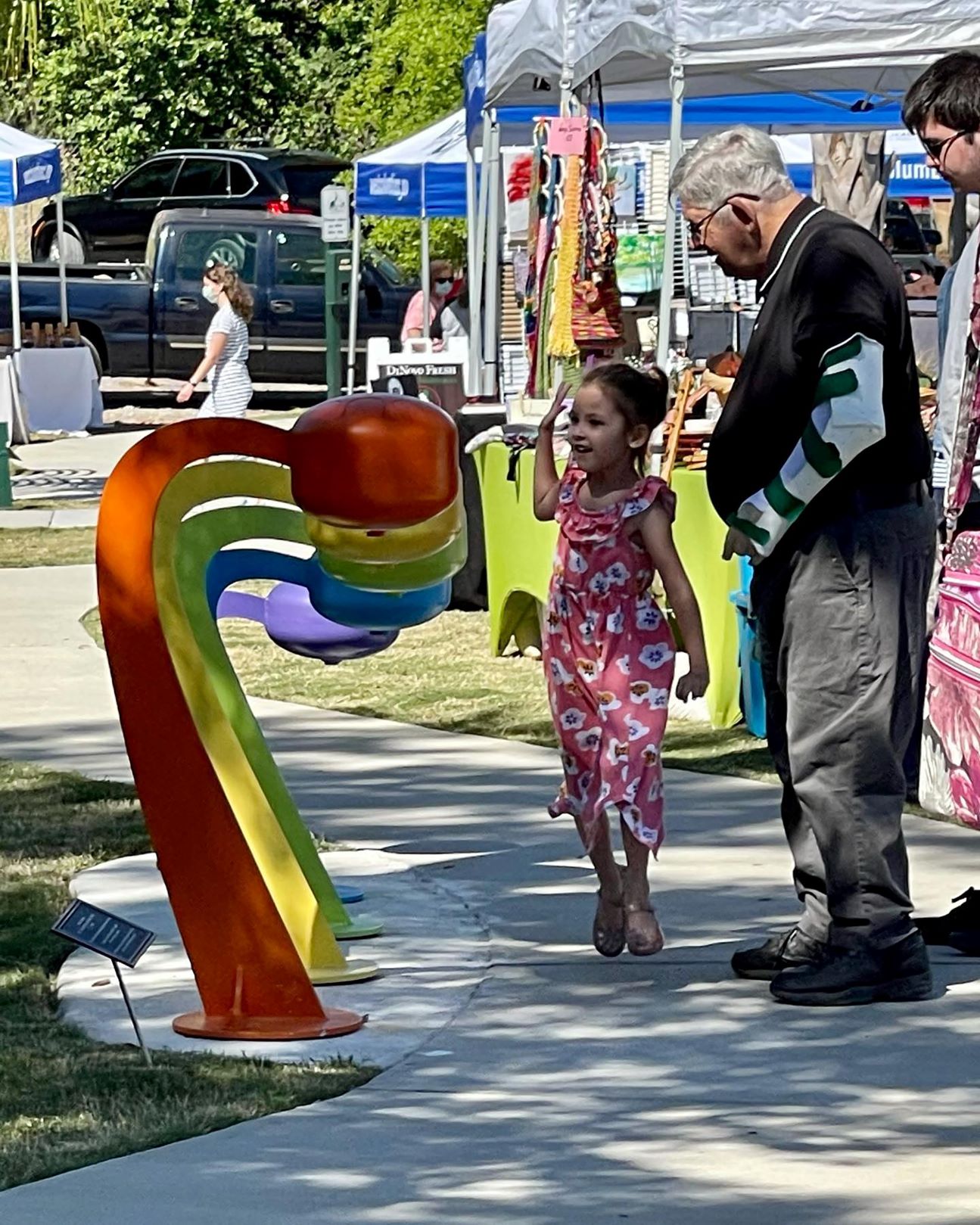
West Columbia’s Interactive Art Park connects the city’s
riverfront to a new brewery and the Meeting Street
Artisan Market. Photos: City of West Columbia.
Carraway Park was expanded to include ADA-compliant pathways and play features accessible to children of all abilities. An open-air artisan market runs every Saturday at the nearby Interactive Art Park, which was funded in part by a Hometown Economic Development Grant from the Municipal Association.
The Brookland Apartment Homes complex, recently developed in the area, brings additional vitality to the River District. Bearing West Columbia’s original name, the first building of the development opened in 2018, offering 220 apartment homes and 200 parking spaces in the adjacent garage.
In Pickens County, the City of Easley is capitalizing on the expansion of the Doodle Trail, an 8.5-mile multiuse trail. Opened in 2015, it connects Pickens with Easley along the former Pickens Railway, a historic short-line freight railroad. Easley’s main trailhead at Doodle Park has a playground, exercise equipment, bicycle rentals, facilities and repurposed freight cars displaying vintage city maps. Recent expansions have connected Doodle Park to the existing path to downtown Easley.
About 30,000 people utilize the Doodle Trail every year, said Chase Campbell, special events coordinator for Easley. When the pandemic began, many people took to socially-distanced outdoor activities like hiking, biking and running, and so that number could be much higher. According to a Rails-To-Trails Conservancy report, 2020 saw a 51% uptick in trail use over the previous year, with the highest surge showing a 200% increase last spring.
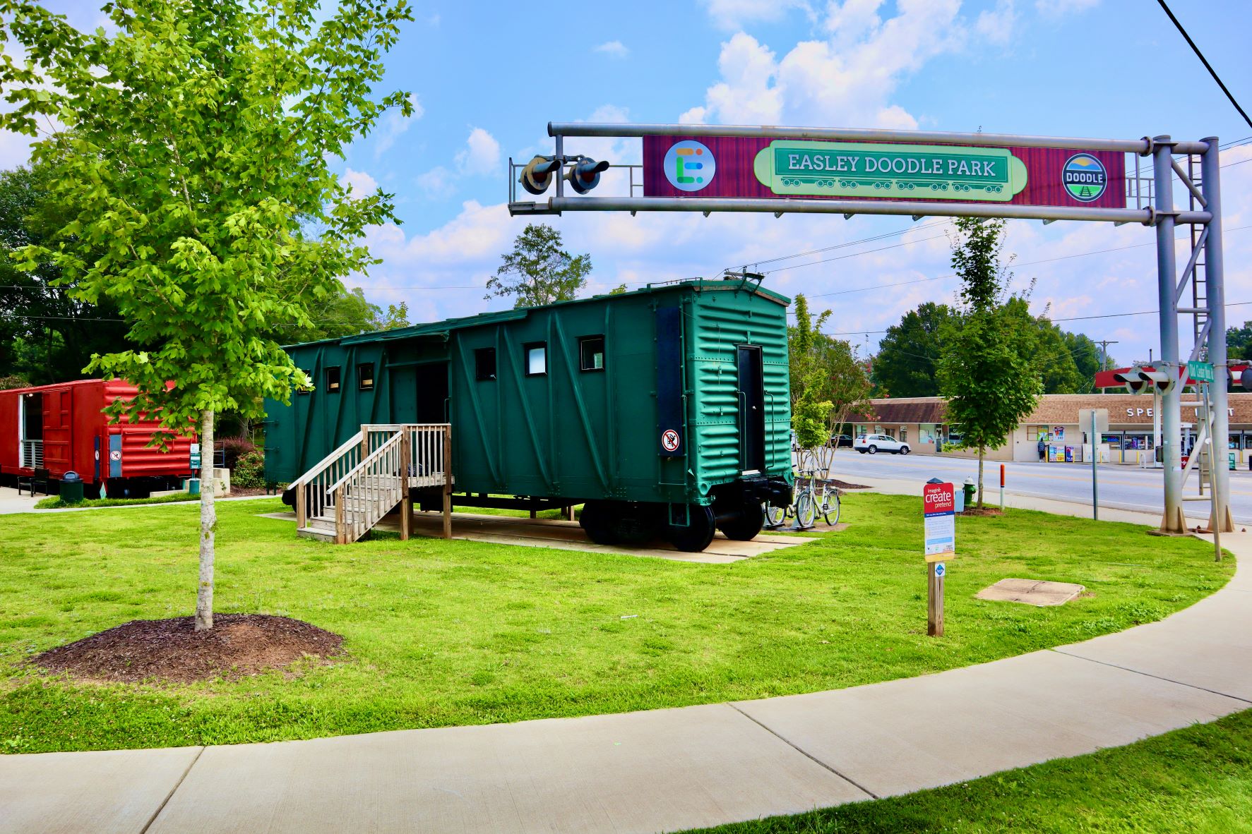
Easley’s Doodle Park provides an interactive trailhead for the Doodle Trail.
Photo: City of Easley.
The City of Easley recently purchased more than 40 dilapidated homes to make way for the new Trailside Affordable Housing development. Five homes have been built so far, with plans to build a total of 12. To emphasize the trail’s popularity coupled with the success of special programming and events, a recent concert brought over 10,000 people to the downtown square.
“When [visitors] come for special events, they usually will stay in a hotel and go to The Doodle Trail. They’ll also go to our Nalley Brown Nature Park; they’ll go to the downtown, Old Market Square, and to our farmers market,” Campbell said.
The city plans to extend its portion of the Doodle Trail to the new Silos District and a soon-to-be-constructed residential complex that will eventually add more than 300 apartments.
In the upstate City of Belton, the converted railroad path is known as the Bubble Gum Rail Trail, a project of the nonprofit Belton Alliance, which made use of a Hometown Economic Development Grant from the Municipal Association. The trail’s name comes from stories of a conductor who would throw bubble gum to crowds of children.
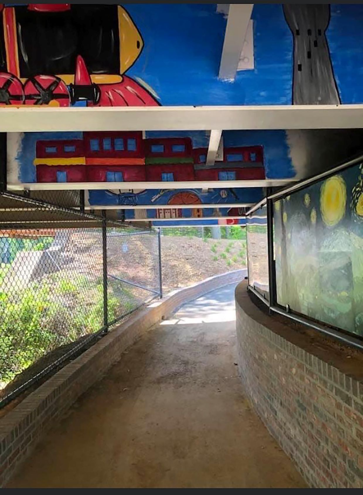
Murals now decorate the Bubble Gum Rail Trail’s passage under
a bridge in Belton. Photo: City of Belton.
Belton Mayor Eleanor Dorn described the trail as a gift for the community that has brought more traffic downtown. She drew attention to the restaurants situated along the trail, including one that opened shortly before the ribbon cutting of the trail in May.
“We have a whole package going on right now — all kind of positive things that the trail is the start of,” she said.
In Mauldin, the extension of the Prisma Health Swamp Rabbit Trail became one step closer to reality when the city council recently approved a $5 million development plan for a pedestrian bridge over Interstate 385.
“The Swamp Rabbit Trail is a recreational game-changer, and it completely revitalized some small towns,” said Councilmember Taft Matney, chair of the Mauldin’s economic planning and development committee. “Our hope is that we continue to extend the Mauldin [portion of the] Swamp Rabbit Trail into our downtown.”
The City of Mauldin received a donation from AT&T last fall for a new trailhead at the start of the pedestrian bridge along East Butler Road. Upon completion, the new trailhead will link Mauldin High School to the elementary and middle schools, as well as to the Golden Strip Career Center and eventually to Clemson University’s International Center for Automotive Research.
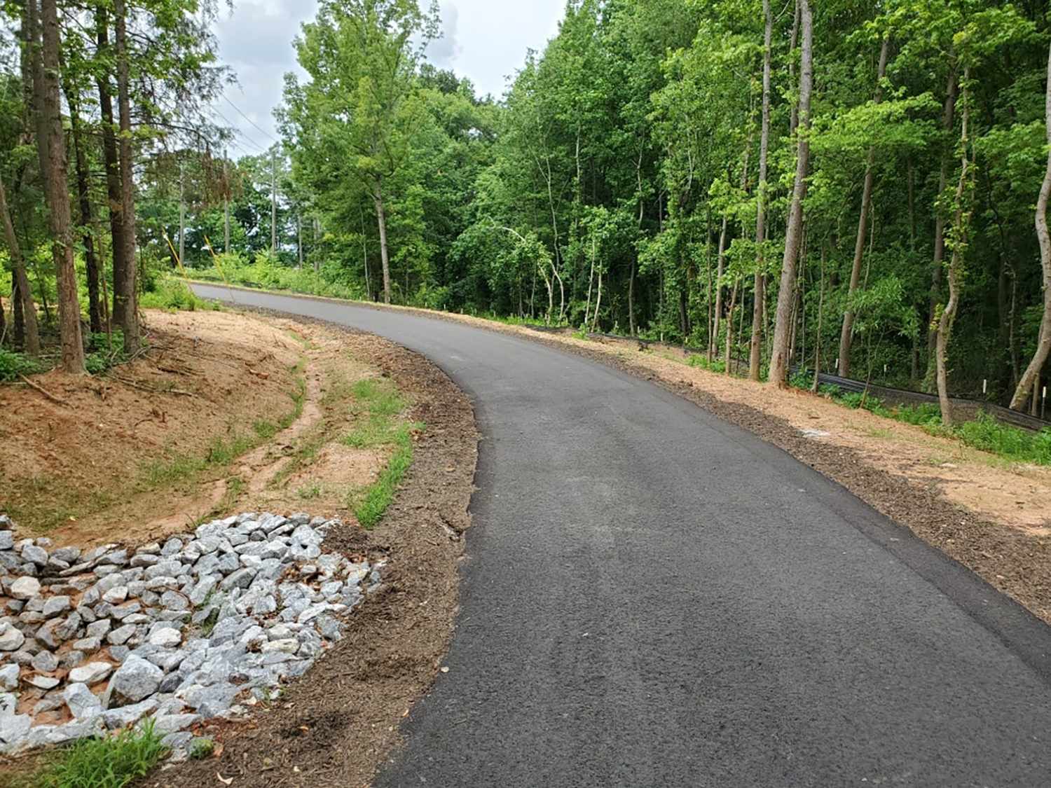
Mauldin has a recently completed trailhead extension for the
Swamp Rabbit Trail. Photo: City of Mauldin.
The extension of the Swamp Rabbit Trail and pedestrian bridge will also connect with the under-construction BridgeWay Station development, a planned downtown-style urban center project off of Bridges Road. Boasting $150 million in investments with more on top as additional phases build out, Matney said it is expected to be transformative for the region.
Ty Houck, director of greenways, natural and historic resources for Greenville County Parks, Recreation and Tourism, said that between 2012 and 2016 approximately $7 million of annual tourism revenue was generated from “people coming to town to eat, drink and sleep because their visit included the [Swamp Rabbit] trail.”
Houck added that additional trail data showed that every dollar invested in community infrastructure had a $2.30 return on investment — money going straight back to the region, thanks to trail-related economic development activities.
The groundbreaking of the pedestrian bridge over I-385 is anticipated for this fall, with the East Butler Corridor Swamp Rabbit Trail extension expected to begin by 2023.
“With the original Swamp Rabbit Trail 22 miles long, [the] other ‘Golden Strip’ cities of Mauldin, Simpsonville and Fountain Inn would also want the trail extended as it would allow for recreational tourists to be able to travel Greenville County from north to south,” councilmember Matney added.
As community trails continue to grow in popularity, perhaps now is the time for cities to turn towards the great outdoors.
